Since the time of Darwin, islands have served as model systems for the transformative study of numerous phenomena including evolution, nutrient cycling, and speciation. As bounded systems, islands can be studied as discrete environments in which biotic and abiotic components interact to produce identifiable patterns.
The Island of Hawai’i provides a model system in which the complex interaction of human society with energy, water, and the flows of materials can be clarified and measured. The island’s two major urban areas, Hilo and Kailua-Kona, both struggle with limited resources, import dependence, limited economic diversity, and the potentially unsustainable use of ecosystem services.
As urban island areas develop and become more dependent on imports, both their socio-economic and ecological systems become more vulnerable to hazards and disasters. This leads to an overarching question: how can an urban area in an island setting become more sustainable in a resource-constrained world with minimal negative impacts to local ecosystems? This question is acutely relevant to the remote Hawaiian Islands, characterized by a unique combination of ecological, physical, social, cultural, and economic factors.
To improve understanding of the patterns, processes, and implications of human-nature interactions in Hilo and Kailua-Kona, this project is investigating the industrial metabolism as well as the dynamics of land-use and land-cover change of these two areas.Including both in this study will provide an opportunity to conduct a comparative analysis of the structure and function of two socio-ecological systems related through resource exchanges and geographic proximity and characterized by different, yet comparable, development trajectories. Additionally, the historical and contemporary configurations of native Hawaiian culture, along with relatively few, well-defined immigration waves, provide a bounded case of socio-cultural interaction that would be difficult to discern and assess in larger urban areas on the mainland.
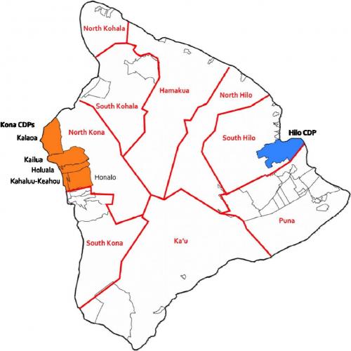
For this study, Census Designated Places (CDPs) are used as the boundaries of the two urban areas, Hilo and Kailua-Kona. CDPs were chosen as the unit of analysis because Hawaii has no incorporated places. Other CDPs on the island are represented as uncolored. Also shown in red are the nine judicial districts of the island.
This project is supported by a grant from the National Science Foundation.